| Publicaties | Instituten | Personen | Datasets | Projecten | Kaarten | ||||
Gridded abundance maps of marine birds around the Azores
Citatie
Flanders Marine Institute (VLIZ); Royal Netherlands Institute for Sea Research (NIOZ); (2015): Gridded abundance maps of marine birds around the Azores; European Marine Observation Data Network (EMODnet) Biology project (www.emodnet-biology.eu), funded by the European Commission’s Directorate - General for Maritime Affairs and Fisheries (DG MARE). https://marineinfo.org/id/dataset/5459
Contact:
Beschikbaarheid:
 Deze dataset valt onder een Creative Commons Naamsvermelding-NietCommercieel-GelijkDelen 4.0 Internationaal-licentie. Deze dataset valt onder een Creative Commons Naamsvermelding-NietCommercieel-GelijkDelen 4.0 Internationaal-licentie.Afbeeldingen (2) Beschrijving
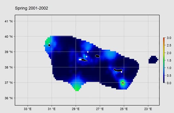
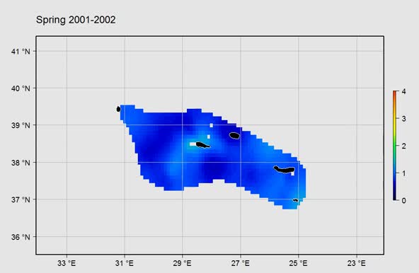
Gridded abundance map of marine birds around the Azores. This product was developed with DIVA (Data-Interpolating Variational Analysis). Data was provided by the Azores Fisheries Observation Programme (POPA). meer
This dataset is based on: Machete, M.; Institute of Marine Research (IMAR), Portugal; Department of Oceanography and Fisheries, University of the Azores (DOP/UAC), Portugal; (2014): POPA- Fisheries Observer Program of the Azores: Seabird sightings in the Azores tuna fishery from 1998 to 2013: during the capture of live bait. http://dx.doi.org/10.14284/10 Machete, M.; Institute of Marine Research (IMAR), Portugal; Department of Oceanography and Fisheries, University of the Azores (DOP/UAC), Portugal; (2014): POPA- Fisheries Observer Program of the Azores: Seabird sightings in the Azores tuna fishery from 1998 to 2013: while fishing. http://dx.doi.org/10.14284/12 Machete, M.; Institute of Marine Research (IMAR), Portugal; Department of Oceanography and Fisheries, University of the Azores (DOP/UAC), Portugal; (2016): POPA- Fisheries Observer Program of the Azores: Seabird sightings in the Azores tuna fishery from 2000 on: during navigation or search mode. http://dx.doi.org/10.14284/11 Scope Thema's: Biologie > Vogels Kernwoorden: Marien/Kust, Analyse, Biota, Data niet gecontroleerd, Geen beperkingen op publieke toegang, Geowetenschappelijke informatie, Interpolated mapping, Metadata niet gecontroleerd, NetCDF (Network Common Data Form), Oceanen, Regionaal, Systemen voor verwijzing door middel van coördinaten, WGS84 (EPSG:4326), ANE, Azores, Calonectris diomedea (Scopoli, 1769), Larus cachinnans Pallas, 1811 Geografische spreiding ANE, Azores [Marine Regions] Spreiding in de tijd
2000 - 2009 Taxonomic coverage
Bijdrage door
Gerelateerde datasets
Bron datasets: POPA- Fisheries Observer Program of the Azores: Seabird sightings in the Azores tuna fishery from 1998 to 2013: during the capture of live bait, meer POPA- Fisheries Observer Program of the Azores: Seabird sightings in the Azores tuna fishery from 1998 to 2013: while fishing, meer POPA- Fisheries Observer Program of the Azores: Seabird sightings in the Azores tuna fishery from 2000 on: during navigation or search mode, meer
URL's
Dataset informatie: Other: Dataset status: Afgelopen
Data type: Dataproducten
Data oorsprong: Monitoring: veldonderzoek
Metadatarecord aangemaakt: 2016-10-07
Informatie laatst gewijzigd: 2024-12-04
| ||||


