Sea level varies constantly on geological timescales, with evidence of transgressions, regressions and stillstands preserved in the sedimentary record. During the Quaternary period (the last 2.5 million years), successive glacial and interglacial periods caused global sea level to fall and rise, exposing parts of our shelf seas during lowstands, and flooding coastal areas during highstands. The southern North Sea became a vast plain during periods of lower sea level; a plain through which major rivers flowed, plants and animal thrived, and our ancestors lived, worked and migrated. Preserved peat found on the present-day seafloor, as well as fluvial and intertidal sediments, are an archive of the constantly changing landscape and climate.
The ‘Seascapes Past and Future’ (SPF) Research group specializes in the imaging, reconstruction and characterization of these former landscapes, whether far away offshore or near to the present coastline, the geomorphological features within them, and their evolution through time. This forms the foundation on which submerged geo-archaeology is built; these palaeolandscape reconstructions are subsequently used to determine hotspots for potential archaeological material. On a more general level, the group is also involved in geological and geophysical projects related to very-high-resolution imaging of the sub-seafloor. The main techniques used to achieve this involve geophysical (mainly seismic and acoustic) systems and ground-truthing using sediment cores.
The present research of the SPF team is reflected in three main research lines:
Reconstruction of drowned landscapes: how did the landscape of the southern North Sea evolve during the late Quaternary (roughly last 150.000 years), what remains of these landscapes including traces of human presence, how did the climate change;
Characterization of the nearshore environment: evolution and modelling of the coastline area over the last 7000 years, what was the effect of man on this process and vice-versa, how did the local sea level change;
Very-high-resolution imaging of the sub-seafloor: how can we spatially image and visualize, in 2D and 3D and in the highest possible detail, structures and objects below the seafloor.
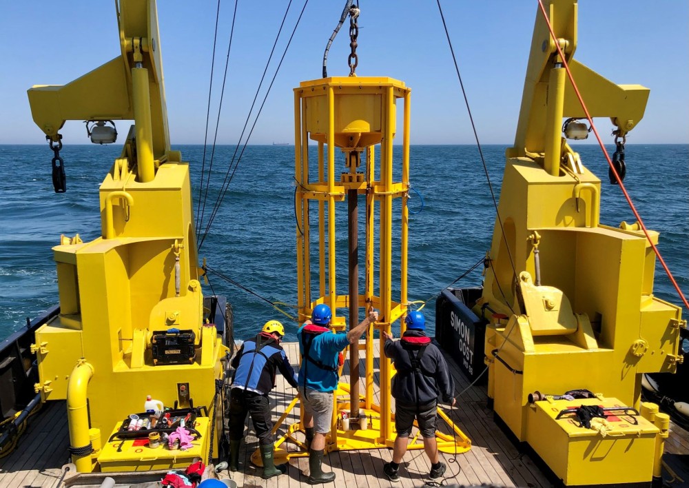
For this research, the SPF group makes maximum use of VLIZ’ extensive infrastructure (RV Simon Stevin, RV Abbé Mann, seismic and acoustic sources, single- and multichannel streamers, vibrocore, sedimentology lab, core storage). In addition, autonomous vehicles (a.o. AUV Barabas, USV Gobelijn) of the Marine Robotics Centre allow for efficient exploration of the seabed and (shallow) subsurface.
The Team
Dr. Tine Missiaen (tine.missiaen@vliz.be) – Head of research group
Dr. Ruth Plets (ruth.plets@vliz.be)
Dr. Thomas Mestdagh (thomas.mestdagh@vliz.be)
Dr. Victor Cartelle (victor.cartelle@vliz.be)
Dr. Hakan Saritas (hakan.saritas@vliz.be)
Despina Kyriakoudi (despina.kyriakoudi@vliz.be)
Warre Dekoninck (warre.dekoninck@vliz.be)
Morgan Vervoort (morgan.vervoort@vliz.be)
Key publications
Missiaen, T., Fitch, S., Harding, R., Muru, M., Fraser, A., De Clercq, M., Moreno, D.G., Versteeg, W., Busschers, F.S., van Heteren, S., Hijma, M.P., Reichart, G.-J., Gaffney, V., 2021. Targeting the Mesolithic: Interdisciplinary approaches to archaeological prospection in the Brown Bank area, southern North Sea. Quaternary International, 584, 141–151. https://doi.org/10.1016/j.quaint.2020.05.004
Irene Waajen-Labee, Ruth Plets, Víctor Cartelle, Marieke Cuperus, Timme Donders, Sytze van Heteren, Thomas Mestdagh, Friederike Wagner-Cremer, Jakob Wallinga, Frank Wesselingh, Freek Busschers, 2025. Sedimentary architecture of the Brown Bank Formation (Dutch sector of the North Sea) reveals consecutive shallow marine depositional phases during the MIS 5-4 transition. Quaternary Science Reviews, 365, 109442. https://doi.org/10.1016/j.quascirev.2025.109442.
Hakan Sarıtaş, Thomas Mestdagh, Harisma Andikagumi, Ruth Plets, Tine Missiaen, Marc De Batist, Bruno Stuyts, Hans Pirlet, 2025. Pseudo-3D Seismic Imaging of Shallow Structural Deformations for the Development of New Windfarms Offshore Belgium. 86th EAGE Conference, 2025, p. 1-5. DOI:10.3997/2214-4609.202510480
Víctor Cartelle, Soetkin Vervust, Wout Van Wesemael, Thomas Mestdagh, Yagız Arda Çiçek, Christian Schwarz, Tine Missiaen, Marc De Bie, Ruth Plets. 2026. Advantages of integrated geophysical, sedimentary, and dating approaches for reconstructing Holocene tidal inlet evolution: A case study from offshore the Belgian coastal plain. Geomorphology, 505. DOI: 10.1016/j.geomorph.2026.110311
Morgan Vervoort, Ruth Plets, Despina Kyriakoudi, Tine Missiaen, Marc De Batist. 2026. Geomorphology of the Axial Channel (Southern Bight, North Sea). Journal of maps, 22:1, 2620910. DOI: 10.1080/17445647.2026.2620910
- Despina Kyriakoudi, Marc De Batist, Morgan Vervoort, Thomas Mestdagh, Tine Missiaen, Ruth Plets, 2026. Multi-criteria characterisation of buried incised valleys to unravel the late Quaternary landscape evolution south of Dogger Bank (southern North Sea). Quaternary Science Reviews, 389 (2026), DOI: 10.1016/j.quascirev.2026.110119
Projects
2023-2025. CLAY TECONICS: Influence of clay tectonics in the North Sea on offshore wind foundation design and installation. Funded by VLAIO. Coordinated by VLIZ.
2019-present. DEEP HISTORY: Revealing the palaeolandscape of the southern North Sea. Internal VLIZ Funding. Coordinated by VLIZ.
2020-present. Palaeolandscape of the Scheur. Internal VLIZ funding. Coordinated by VLIZ.
2023-2029. Life on the Edge: Studying the coastal zone of the Late Palaeolithic. Funded by UKRI Future Leaders Fellowship (UK). Coordinated by Bradford University (UK).
2023-2027. Taken at the Flood: ensuring sustainable heritage strategies for green energy development in the North Sea. Funded by AHRC (UK). Coordinated by Bradford University (UK).
2021-present. Archaeological desktop studies in the Princess Elisabeth windfarm zone. Funded by FOD Economie. Coordinated by Periplus (NL).