03 / 12 / 2008
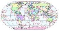 In 2006 the Maritime Bounderies Geodatabase (MARBOUND) is developed with the Exclusive Economic Zones (EEZ's) of all countries worldwide. The data was compiled from internet sources and original documents.
Since November 2008, a new version (2.0) of the EEZ's shapefiles is released. The download package includes three shapefiles. The first shapefile is a polyline shapefile representing the world maritime boundaries. The second one is a polygon file representing the Exclusive Economic Zones. The third one is the extended continental Shelf of Australia Download here the whole package.
The MARBOUND database was picked up by the Google community very quickly. It is even visible as a layer for Google Earth. These layers consist however still of version 1.0 of the EEZ's.