25 / 08 / 2021
The oceans take up an estimated quarter of the global CO2 emissions from human activity. To how much CO2 increase this exactly leads in the surface waters in certain parts of the ocean and coastal seas, and how that varies per region and over time, is still not fully clear yet. In situ measurements made on that immense ocean – covering 71% of our planet – are not too numerous and not yet covering the full surface area.
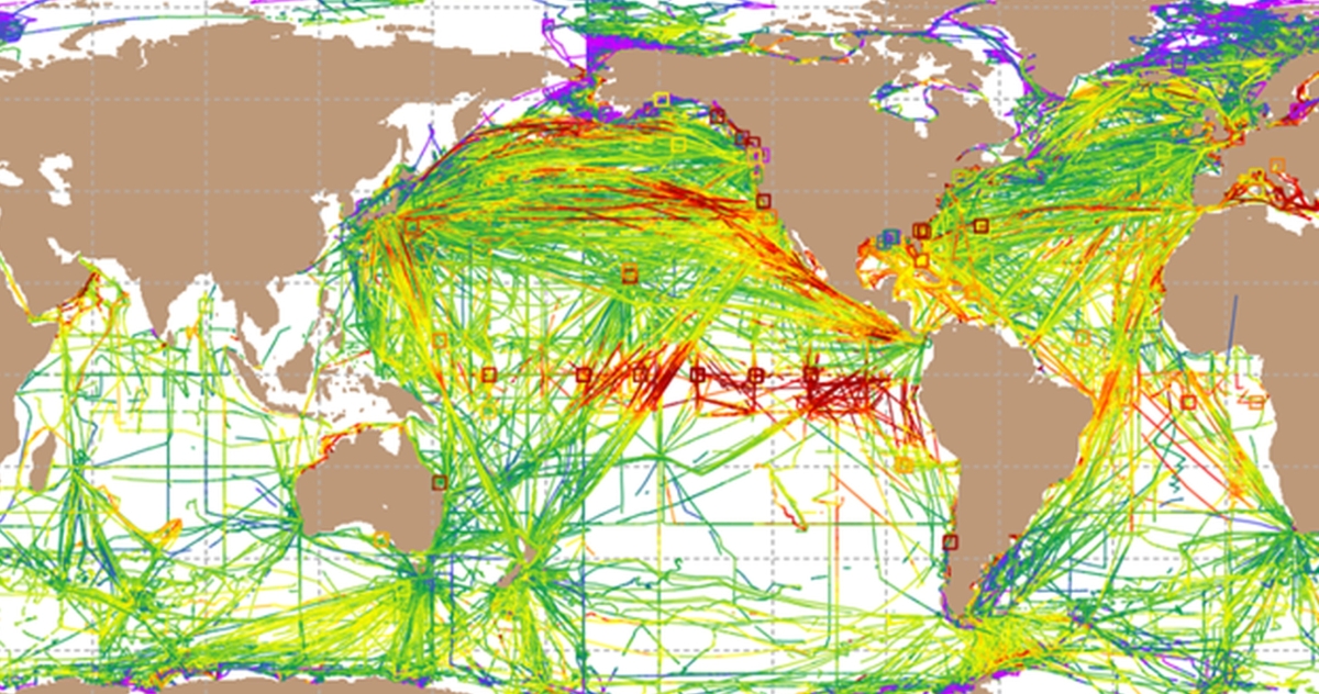
A group of more than 100 international marine carbon researchers brings together all available (since 1957) in situ measurements made by ships, buoys, autonomous and floating platforms in the community-led Surface Ocean CO2 Atlas (www.socat.info). Since the start of this database in 2007, more and more data has been collected in it, and both its accuracy and quality control have only improved since then.
SOCAT-based data products (such as the Global Carbon Budget) are used to quantify the carbon sink and ocean acidification, and to evaluate sensor data and biogeochemical models. The data also finds its way into climate models that provide key information to policymakers in climate negotiations about the ocean's uptake of CO2.
At the beginning of summer, the 2021 edition of the Surface Ocean CO2 Atlas has been launched, now containing 30.6 million quality-controlled observations from the global ocean and coastal seas in the period between 1957 and 2020. In the pandemic years 2020-2021 new data was added, though less than usual in other years. The CO2 measurements that VLIZ has been carrying out since 2015 with the research vessel RV Simon Stevin and the measuring buoy at the Thornton Bank also contribute to the SOCAT atlas. This data is of a certified high quality level.
In situ CO2 measurements on the ocean are not always guaranteed of long-term financing. Europe and Flanders however are contribution well by supporting the Integrated Carbon Observation System (ICOS). This network contains already 23 marine measuring stations on ships and buoys active in the Atlantic Ocean and the Nordic, Baltic and Mediterranean Seas. The ICOS measurements flow (partly automatically) to the SOCAT database. Elsewhere in the world, measurements are often limited to temporary projects or sensors on ships of opportunity. Standardization and quality control therefore remain an important step when bundling the global data into one atlas. A process in which Thanos Gkritzalis, marine chemist at the Flanders Marine Institute (VLIZ) was heavily involved in this year.
SOCAT is a core data product of the Global Ocean Observing System for biogeochemistry, approved by the Global Ocean Observing System GOOS.
Download the release poster of the SOCAT 2021 atlas: