| Publications | Institutes | Persons | Datasets | Projects | Maps | ||
|
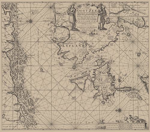
Van Keulen (1728, kaart 22)
Description Paskaart Voor een Gedeelte der Oost Zee Beginnende van Lemsaal tot Beooste Kok als mede de Kust van Oost Finlandt van 't Alandse Haff tot Parna waar in ook vervat is d'Eyolande Oesel en Dagho Naaukeurig opgestelt en van veel fouten verbetert
Datum:1728
Plaats: Oostzee, Golf van Finland, Golf van Riga
JPG file - 4.05 MB - 7 021 x 6 218 pixels
added on 2011-07-291 555 viewsFrom reference Voogt, C.J.; van Keulen, G. (1728). De Nieuwe Groote Lich... (page [78])
This work is licensed under a Creative Commons Attribution-NonCommercial-ShareAlike 4.0 International License
Click here to return to the thumbnails overview |

