| Publications | Institutes | Persons | Datasets | Projects | Maps | ||
|
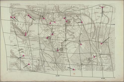
Carte chorographique de la Belgique dédiée à la Convention Nationale
Description The distortion grid and the displacement vectors provide a representation of the geometric accuracy of the map and were generated using MapAnalyst (Jenny & Hurni 2011).
JPG file - 2.90 MB - 5 000 x 3 302 pixels
added on 2016-03-18269 viewsMap based on Jenny, B.; Hurni, L. (2011). Studying cartographic herita...
Kaart: 4 Berg-op-Zoom (1793)
This work is licensed under a Creative Commons Attribution-NonCommercial-ShareAlike 4.0 International License
Click here to return to the thumbnails overview |

