Macrobel image
Chaetozone setosa
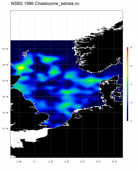
Description Gridded abundance map of the polychaete Chaetozone setosa in the North Sea in 1986. This product was developed with DIVA (Data-Interpolating Variational Analysis) and the Scale: log-transformed abundance. Data was derived from the 1986 North Sea Benthos Survey.
Citation: European Marine Observation Data Network (EMODnet) Biology project (www.emodnet-biology.eu), funded by the European Commission’s Directorate - General for Maritime Affairs and Fisheries (DG MARE).
The mapped images, raster files and used parameters can be downloaded here.
Author NIOZ, VLIZ
·  PNG file - 64.84 kB - 1 594 x 1 968 pixels
added on 2015-03-092 743 viewsMacrobel taxa Chaetozone setosa Malmgren, 1867Part of dataset Gridded abundance maps of the benthic species from the No...
 This work is licensed under a Creative Commons Attribution-Noncommercial-Share Alike 4.0 License
[Add comment]
Disclaimer: Macrobel does not exercise any editorial control over the information displayed here. However, if you come across any misidentifications, spelling mistakes or low quality pictures, your comments would be very much appreciated. You can reach us by emailing info@marinespecies.org, we will correct the information or remove the image from the website when necessary or in case of doubt.

 Comment (0)