
On this page you can read the daily reports. Click on the date to open and close the text.
Leg 1: Brest – La Coruña (Gulf of Biscay) |
 |
 |
Hi sailors!
Today we are already Thursday and just spent our first night out at sea. This might be the right time to summarize what happened the last couple of days.
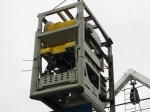
On Tuesday Dries, our ROV-engineer, became 24 years old and especially for his birthday he got… a lot of problems with the ROV. The first tests pointed out that something was seriously wrong with the power-supply of the system. The rest of the day our engineers, Jeroen, Dries, Arne, Wim and Koen were busy repairing this malfunction. Late at night it appeared that in the heart of the electronic system, 2 wires were switched and misconnected. This problem was easily solved, so our engineers were able to end this frustrating day with a first success.
While the engineers were busy repairing our yellow robot, the scientists: Lies, Jean-Pierre, Hans and Jens, had a few meetings with the commander and some French scientists from Ifremer. At ten o’clock there was also a press-conference on the ship for the local papers and radio-stations. Our ROV, Genesis, is now world-famous in the area around Brest… Today we also welcomed our French participant, Frédéric, on board of the ship. His job is to map areas along the French coast with a high biodiversity which should be protected in the future.
The departure of the Belgica was scheduled Wednesday around 8 o’clock in the morning. However, because of the malfunction of the power-supply on Tuesday, the ROV was not ready for a test-dive. Therefore we decided to postpone the departure till 4 o’clock in the afternoon. When we left Brest under a radiant sun, we sailed towards the Bay of Douarenez where we performed a first dive with Genesis in shallow water to test if everything works. Unfortunately this was not the case: the altimeter, the compass and the photo-camera don’t work. Our engineers are at the moment very busy localizing these new malfunctions. Let’s hope these problems will be solved rapidly… Last night Jens and Lies were busy calibrating the multibeam-system in order to map the topography of the study-area. After some setbacks the system seems to be running with some slight problems. Today, the seismic-system was also tested and is working quite well. When we reach our destination, we will start mapping the area with the multibeam for 36 hours in order to get a detailed topography of the sea-bottom. Hopefully we will discover some coral-reefs or other interesting structures.
As you’ve just read we still have some problems with the ROV up ahead but we are confident that our engineers will be able to solve them. In the mean time the scientists will start with the mapping of the study-area. You will read more news in the coming days.
For the ROV engineers, it becomes a second full day of “trouble shooting”, but they progress steadily. Incredible how many functions can fail on a system straight back from the factory for revision and maintenance. For each failure, our engineers trace back the possible bugs step by step, level by level. No oil-filled box remains unopened, no circuit board escapes thorough checks. But at the end of the day, all functions seem to have come back to life, with the exception of the hydraulic arm, which has a severe error on a control board. It will not be available for this leg of the expedition, but a spare board is underway to the port of La Coruna for making the hydraulic arm available for the second leg.
While the engineers worked on the ROV, the exploration with our surface tools continued, 24 hours on 24. The detailed morphology of the so-called Penmarc’h Bank has been fully imaged by multibeam echosounding. With this tool, we can map the relief of the seafloor over a width of 900 to 1000 m in one track. By sailing a line every 1000 m, we obtain a full coverage of the seafloor and can easily map an area of 120 km² in half a day. During the night of Friday to Saturday, we started the seismic profiling. This provides us with continuous geological cross-sections, down to depths of a few hundreds of metres below the seafloor. Slowly, we start to understand the geology of this continental margin.
 |
 |
Dear all,
Today we are Sunday the first of June. Everyone is still recovering from the excellent barbeque we had yesterday, on the back-deck while watching the sun go down. Unfortunately on a ship, a Sunday is not a resting-day, so we had a lot of work to do today. During the night we started up the multibeam mapping again and in the morning a general meeting was held where the planning of the rest of the cruise was discussed.
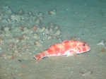
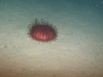
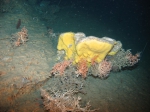
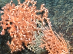
Around noon, the ROV was lowered towards the sea bottom for a second reconnaissance dive. We dove slowly from 700 to a depth of 900 meters along the steep flanks of the continental slope and observed big bushes of Lophelia and Madrepora corals (Yes!). These coral-communities provide a habitat for a lot of living organisms such as: echinoids, crinoids, crabs, sharks and fishes in all kinds of colors. During the dive we also came across oysters that live on the vertical ridges of the canyons. These oysters were also observed during a dive with our ROV 2 years ago at La Chapelle Bank, on the Celtic margin. The ROV-team truly did an excellent job and came up with some spectacular images of the breath-taking coral-world almost a kilometer beneath the surface of the sea./
After 5 hours of diving, the ROV was brought back on deck for a well-deserved rest and check-up. Everyone was really pleased with the discoveries that were made during this reconnaissance of the sea-floor. Let’s hope this sets the stage for other really interesting dives. Right now, we are trying to relax a little bit, but not too long because we will start with the multibeam-mapping again in a few hours for the rest of the night. In the comings days, we will come back to you with other glimpses of the live on the sea-floor, one of the last pristine and unexplored places of this planet.
 |
 |
 |
Hi everyone!
The last days of the campaign are approaching but we are still quite busy exploring the canyons and spurs on the seabed. Yesterday, June 2, we made some important discoveries during the ROV-dives. The first dive was located on small bumps we were able to distinguish on the multibeam-maps and seismics. These features appear on the seafloor between 200 and 350 below sea-level. The exploration of these small bumps revealed that their surface is completely covered by dead coral rubble. We were actually looking at an extensive coral graveyard. At some point in time the oceanographic conditions must have been quite different, enabling coral-growth on these shallow sites. Nowadays we tend to find living corals a lot deeper on the continental slope. The second dive was on one of these deeper spots at a depth of around 750 m and guess what … we discovered a small mound covered with both living and dead coral. Everyone was ecstatic about the discoveries! We really get spoiled during this cruise with spectacular findings.
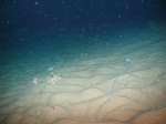
Today, during the ROV-dive, we made a transect of the continental slope from 300 m towards a depth of 750 m. The upper parts of the slope appeared to be quite monotonous: a lot of sediment waves and from time to time some fishes or sea-urchins. Right at the moment we were about to give up, we discovered a cliff colonized by oysters and corals. Victory! Again this finding was made at a depth of around 750 m. Apparently this depth provides the right conditions (pressure, salinity, currents, density,…) for coral growth.
When we wanted to go back to the seabed for a second dive, the engineers came across some problems and they are busy solving them right now. Let’s hope we will be able to make a final dive tomorrow before setting course towards La Coruna. In the mean time we will start another night of multibeam and seismics.
You will read the stories of the last part of this campaign in one of the days to come…
 |
 |
This morning, after again a whole night of seismics and multibeam, we prepared everything for the last, and hopefully successful, ROV dive but… unfortunately the same problems are still there. So, no ROV dive anymore for the rest of this cruise. We all hope that they can fix the problem till the next leg of the campaign!
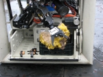
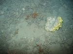
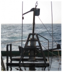
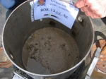
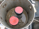
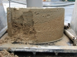
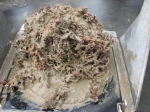
Alternative plan: boxcoring! We selected two areas: one on the south flank of the Guilvinec canyon in water depths of 280 m where small mounds/ridges were recorded on the multibeam data, and which appeared to be covered by death coral rubble (ROV dive 03). The second area is the north flank of the Guilvinec canyon where different facies with coral rubble as well as living species occur. The goal of these boxcores is to determine the different facies and to identify coral species that lived and still live on the site. For every boxcore, we took samples from different locations for sedimentological analyses. We collected some pieces of dead coral rubble for dating. The living species were collected for morphologic studies and the sponge specimens were collected for phylogenetic / genomic studies.
During the night we started again the multibeam mapping, the last lines before we go back to La Coruña tomorrow. The end of a very successful cruise is near...
Pictures: examples of boxcores
 |
 |
 |
 |
 |